American Observatory: Parties to the Sudan Conflict Committed Systematic Violations
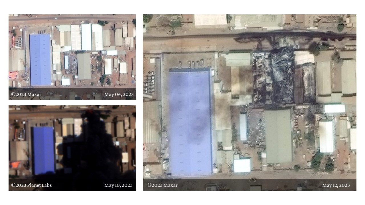
In its first report, the Sudan Conflict Observatory platform documented the destruction of vital facilities in the Sudanese capital, Khartoum, including the Samil PlumpyNut® factory, through satellite images. The report also highlighted other locations across the country.
Late on Friday, the U.S. Department of State announced its support for the platform to publish the results of satellite monitoring operations and ceasefire monitoring.
The report confirmed that the warring parties have committed systematic violations of international humanitarian law, human rights law, and the Juba Declaration and May 20th Agreement on Ceasefire. It revealed widespread destruction of water, electricity, and communication infrastructure, as well as food and human security in Khartoum, North Kordofan, South Darfur, West Darfur, and North Darfur, including the SudaTel towers in Nyala.
The Sudan Conflict Observatory platform is a joint project managed by Esri, a specialized company in Geographic Information System (GIS) software, geographic information, and mapping since 1969. It also involves Planet Labs, which has previously been used in Syria and Myanmar to assess the scale and locations of destruction using artificial intelligence systems and other sources. Additionally, it collaborates with the Yale Human Rights Lab.
The report emphasized that incidents that damage information and communication technology infrastructure prevent civilians from accessing humanitarian assistance, restrict the ability of humanitarian organizations to assess and respond to needs, and may hinder documenting serious human rights violations. It further noted that communications are deteriorating throughout Sudan, including Khartoum State and South Darfur.
The report documented a shift in population distribution in Sudan since the start of the conflict, stating that the population in Khartoum continues to decline, with a significant decrease in population in El Fasher and Nyala, contrasted with an increase in population in eastern cities such as Atbara and Port Sudan. These demographic shifts may also indicate regional mobility restrictions to escape violence.
Planet Labs explained that the attacks were documented using moderate-resolution satellites with high-resolution imagery and thermal sensing devices orbiting the Earth, in some cases.
Pic: Satellite images illustrate the severe damage caused by the fires that engulfed the Samil PlumpyNut® facility in Khartoum in mid-May.
The Samil PlumpyNut® factory, owned by the Salah Abdelrahman Yaqoub Group in partnership with a French company, was opened in 2012 and was one of eleven factories worldwide specializing in the production of therapeutic food products for treating malnutrition in children.
